【题目】地球仪和地图是学习地理的工具,是地理信息的载体。在教室里,有的同学在看地图,有的同学就有关地球和地图的知识向老师请教。据此并依照下图回答有关问题。(5分)
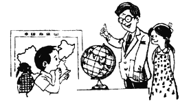
(1)看地图的同学,观察的是( )
A.法国地形图
B.俄罗斯矿产图
C.中国政区图
D.美国交通图
(2)地球仪上可以画出多少条纬线和经线? _______
(3)在地球仪上,可以“坐地日行八万里”的纬线是__________________。
(4)地球的自转方向是_____________,在北极上空观察地球的自转应是___________时针方向。
【答案】
(1)C
(2)无数
(3)赤道(或0°纬线)
(4)自西向东 逆
【解析】
试题分析:
(1)在庞大的地图家族中,有自然地图和社会经济地图。自然地图包括地形图、气候图、水文图、植被图等,社会经济地图包括工业图、农业图、商业图、交通图、人口分布图等。看地图的同学,观察的是中国政区图,故本题选C。
(2)在地球仪上垂直于地轴环绕地球仪一周的圆圈叫做纬线,所有纬线都互相平行,但长度不等,自赤道向南北两极逐渐递减,指示东西方向;连接南北两极的并同纬线垂直相交的半圆叫经线,所有的经线都等长,指示南北方向,地球仪上纬线和经线有无数条。
(3)现在人们对地球的形状已有了一个明确的认识:地球并不是一个正球体,而是一个两极稍扁,赤道略鼓的不规则球体。经过测量,地球的极半径为6357千米,赤道半径为6378千米,地球的平均半径为6371千米,最大周长约4万千米,地球表面积为5.1亿平方千米。在地球仪上,可以“坐地日行八万里”的纬线是赤道(或0°纬线)。
(4)地球不停地围绕地轴自西向东自转,如果我们站在北极上空俯视地球呈逆时针方向,站在南极上空俯视地球呈顺时针方向。

科目:初中地理 来源: 题型:
【题目】读黄河与长江年径流量图,回答下列问题。

【1】从两幅图中能够直接获取的信息是
A.黄河含沙量比长江大 B.长江的径流量比黄河大得多
C.两条河流都有结冰期 D.黄河的汛期比长江的汛期长
【2】我们把长江誉为“黄金水道”,其主要原因是该河流
A.年径流量大 B.航运价值高
C.水力资源丰富 D.流域内资源丰富
【3】下列长江防洪减灾的措施,错误的是
A.围湖造田 B.加固大堤
C.培育防护林 D.利用洼地修建蓄洪区
查看答案和解析>>
科目:初中地理 来源: 题型:
【题目】读下图,回答下列问题:

(1)填出图中字母所代表的干湿地区名称:A 为 地区,B为半湿润地区,C为半干旱地区,D为 地区。
(2)A与B的界限大致为 岭—— 河线。
(3)图中数码①和②代表影响我国的夏季风,①为 季风,②为 季风,它们分别来自 洋和 洋。
查看答案和解析>>
科目:初中地理 来源: 题型:
【题目】读等高线地形图,填出图中字母所表示的山体部位名称:(7分)

(1)C_ __、D_ _、E _ _。
(2)在这幅图中,最高点的海拔至少在_ _米以上。
(3)图中A处位于B处的_ 方向。
(4)如果要从A、B两处爬山,则选择从__ ___处爬山要容易些,原因是_____________。
查看答案和解析>>
科目:初中地理 来源: 题型:
【题目】阅读理解
A city without cars would be very strange,right?But Venice(威尼斯)is such a city.

Venice is in the northeast of Italy.It wasn’t built on land,like Beijing or Shanghai,but on more than 110 islands.Seawater is everywhere around the city.
Even so,travel isn’t that difficult.The waterways have always been the best way to get around.There are 117 waterways and more than 400 bridges that can lead you where you want to go.
People in Venice move from place to place by boat.They like to enjoy the scenery and cool summer nights while taking boat trips.They can talk to other people as they go along.
Venice grew out of small islands in saltwater lakes when some Italians escaped from a war more than 1,500 years ago,and built homes there.
Water makes the city special,but it is also a big problem.
Once,people used too much underground water.This made the city get lower little by little.Now the city has gone down by 23 centimeters.
Another problem is the rising seawater.The temperature has risen over the years.This has made the ice of Arctic Ocean(北冰洋)melt(融化).
Every year,high waters hit the city in autumn and winter.When a lot of water comes,more than half of the city is underwater.
Scientists are trying different ways to stop the city from getting even lower.
【1】According to the article,which picture shows the right position(位置)of Venice?
A.
B.
C.
D.
【2】Which is the most impossible way for people in Venice to get around in the passage?
A.On foot.
B.By boat.
C.By car.
D.By bike.
【3】Why is Venice still getting lower and lower?
A.Because too many people live there.
B.Because people used too much underground water.
C.Because lots of bridges have been built.
D.Because the underground water is rising.
【4】What seasons are dangerous for Venice because of high waters?
A.Summer and autumn.
B.Autumn and winter.
C.Summer and winter.
D.Spring and winter.
【5】The article is mainly about________.
A.the position of Venice
B.the history of Venice
C.the problem of Venice
D.the scenery of Venice
查看答案和解析>>
科目:初中地理 来源: 题型:
【题目】阅读理解
(2014山西)
What does it mean to be green?“Green”is more than just a color.It also means taking special steps to protect the environment—the water,the land,and the air we breathe.Why green?Plants are green,and without them the earth wouldn’t be such a lovely home for us human beings.
Sometimes people call ours a“throw—away society”.That means we are always throwing away old things and buying new ones.Many times,if you no longer need something,someone else just might need it.For example,if your brother is old enough not to play with his plastic bike,why not give it to another family who has a little kid so that they don’t need to buy one?And one less large plastic toy doesn’t need to be produced.
Recycling(回收利用)has never been easier.Many organizations will pick it up right in front of your house and some towns even require(要求)it.Tell your mom or dad you want to become“Chief of Recycling”for your family.Now that you know what things you can recycle,find a place to keep them.Make sure you encourage everyone in your house to think whether things can be reused or recycled before they’re thrown away.
Almost everyone likes traveling.But next time before you travel around the world,take a look at your own backyard.Is there a place where you could plant a tree or put in a little fruit or vegetable garden?If so,get there and get your hands dirty.Then you can watch with pride as your tree takes root,and your garden plants grow into big plants full of ripe,red tomatoes or tiny,juicy blueberries.Who knew being green would taste so good?

【1】In the first paragraph,the writer introduces the topic of the passage by________.
A. telling an interesting story
B. explaining the word“green”
C. giving some special examples
【2】In a“throw-away”society,________.
A. people shouldn’t produce any plastic things
B. people can get anything they want from others
C. people always throw away the used things and buy new ones
【3】To be“Chief of Recycling”.you should________.
A. recycle things all by yourself
B. ask your family to use the old things all the time
C. find a place to keep the things that can be recycled
【4】You are advised to run a fruit or vegetable garden in order to________.
A. creat a green environment
B. make a lot of money
C. get your hands dirty
【5】The purpose of the passage is to tell us that________.
A. we must enjoy nature
B. we had better eat more green food
C. we should protect our environment
查看答案和解析>>
科目:初中地理 来源: 题型:
【题目】读我国沿“北纬30°地形剖面图”,回答下列问题:

【1】图中反映出的我国地势特征是( )
A、西高东低 B、东高西低
C、中部高,四周地 D、北高南低
【2】图中,数字①所在的地形区是( )
A、内蒙古高原 B、青藏高原
C、柴达木盆地 D、黄土高原
【3】从图可知,第三级阶梯上的主要地形是( )
A、山地和高原 B、盆地和高原
C、平原和丘陵 D、平原和盆地
查看答案和解析>>
科目:初中地理 来源: 题型:
【题目】读我国冬季风、夏季风示意图,回答下列问题:(10分)

(1)表示冬季风的是 图,它来自 地区,使我国大部分地区冬季气候特点 。
(2)影响我国的夏季风包括来自于 洋的西南季风和来自于太平洋的 季风,所以我国东部地区夏季的气候特点是 。
(3)我们把 (冬、夏)季风影响明显地区称为季风区,受季风影响,我国东部地区降水集中在 季节。降水的地区分布特点是 。夏季风不稳定易导致 灾害。
查看答案和解析>>
科目:初中地理 来源: 题型:
【题目】读下图,回答下列问题。(10分)

(1)写出图中代号所代表的大洲:
①_______________②_______________③____________________
(2)写出图中字母所代表的大洋名称:
A ______________________ B________________ C_______________________
(3)从图中可知,主要分布在西半球的大洲有_________________洲和________________洲;赤道穿过大陆的大洲是 ______________和 ________________。
查看答案和解析>>
湖北省互联网违法和不良信息举报平台 | 网上有害信息举报专区 | 电信诈骗举报专区 | 涉历史虚无主义有害信息举报专区 | 涉企侵权举报专区
违法和不良信息举报电话:027-86699610 举报邮箱:58377363@163.com